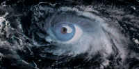
When faced with an approaching storm, being able to have Interactive maps and live weather feeds at your finger tips is extremely important. It’s not just about radar loops and forecasts on the hour and half hour. We need to be able to have information coming in as it occurs. Storm Surge projections, Power Outages, Available Shelters, Evacuation Zones/Routes, can make a difference between surviving a storm and becoming a victim of it.
Something else that is important is the ability to see exactly what a storm is doing to a coastline and the city centers that are located directly in the path of hurricanes. Beach cams are a great source when it comes to the power of these storms.
These interactive maps and live feeds will be updated as needed, and will be accessible directly on the page if possible, otherwise through links.
Go Back to MENU
